Renaturing in Worthing
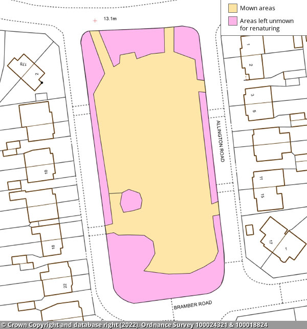
Allington Road Open Space
The main area of the park will be mown.
There will be unmown areas to allow renaturing:
- around the park's perimeter edges
- under trees
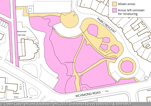
Amelia Park
The footpaths, and borders of the roadside and the areas closest to Park Crescent will be mown, except for areas under tree canopies.
The rest of the site will be unmown to allow for renaturing.
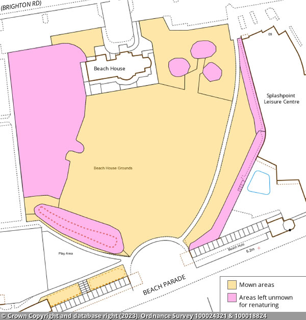
Beach House Grounds
The main area of the park will be mown.
There will be unmown areas to allow renaturing:
- under trees
- the mound to the south
- the perimeter edge beside Splashpoint
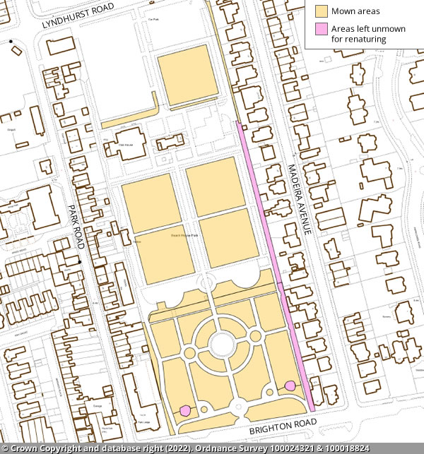
Beach House Park
The main area of the park will be mown.
There will be unmown areas to allow renaturing:
- to the circles to in the south
- alongside the path that runs up the eastern side
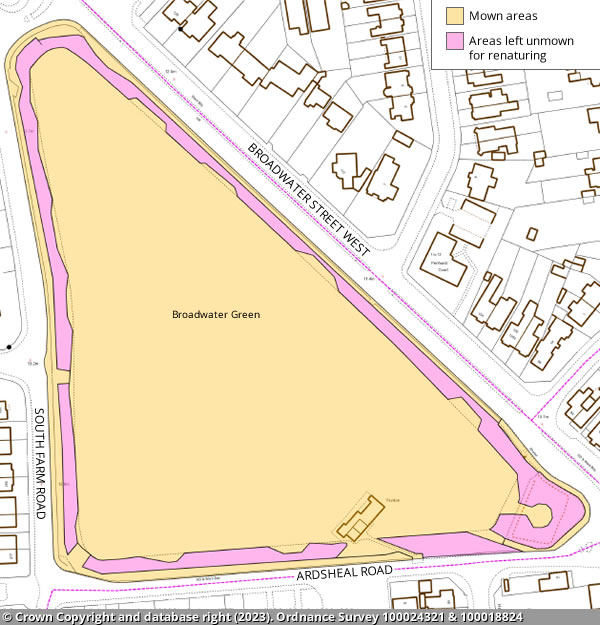
Broadwater Green
The main area of the park will be mown.
There will be unmown areas to allow renaturing:
- around the park's perimeter edges
- on top of the mound in the south east corner
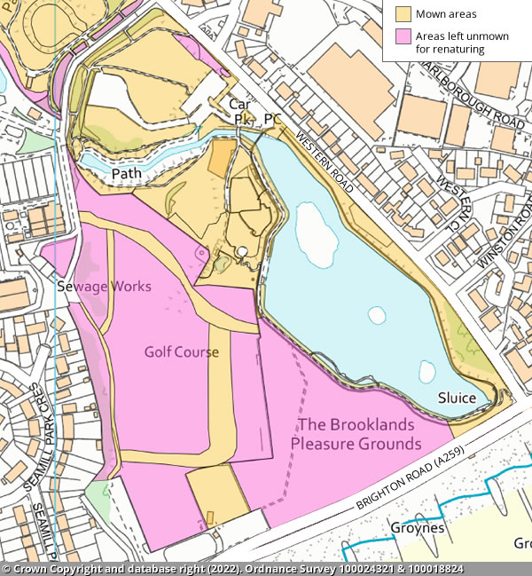
Brooklands Park and Lake
The main area of the park will be mown.
The area to the south west of the lake will be left for renaturing along with the old golf course. Pathways will be mown through the old golf course.
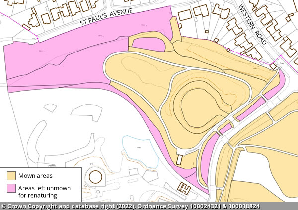
Brooklands Park Amphitheatre
The main area of the park will be mown.
The northern area of the park will be left for renaturing, along with the western boundary for wildflowers.
Charmandean Recreation Ground
The main area of the park will be mown.
There will be unmown areas to allow renaturing:
- around the park's perimeter edges
- under trees
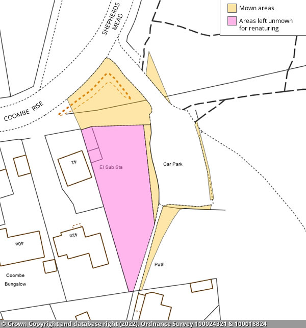
Coombe Rise car park
The main area of the park will be mown.
There will be unmown areas to allow renaturing:
- the area behind the knee rail to the west of the car park
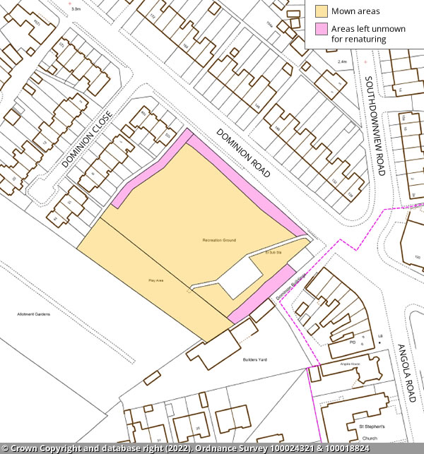
Dominion Road open space
The main area of the park will be mown.
There will be unmown areas to allow renaturing:
- alongside the north west, north east and south east perimeter edges of the park
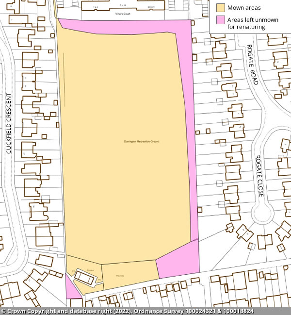
Durrington Recreation Ground
The main area of the park will be mown.
There will be unmown areas to allow renaturing:
- around the park's north and east perimeter edges
- the wooded area to the east of the playground
- the triangle beside the south west entrance
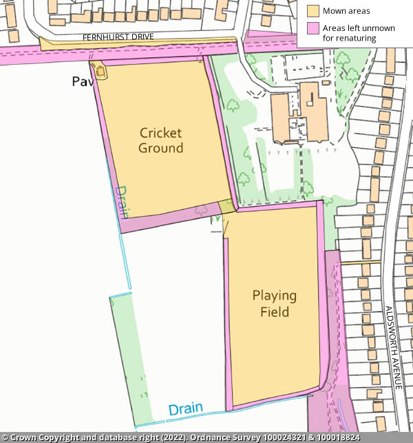
Fernhurst Recreation Ground
The main area of the park will be mown.
There will be unmown areas to allow renaturing:
- around the park's perimeter edges
Goring Green
The main area of the park will be mown.
There will be unmown areas to allow renaturing:
- around the park's perimeter edges
Goring Greensward
The main area of the park will be mown.
There will be unmown areas to allow renaturing:
- around the park's southern perimeter edge
- the area in the middle that is in line with the plantation
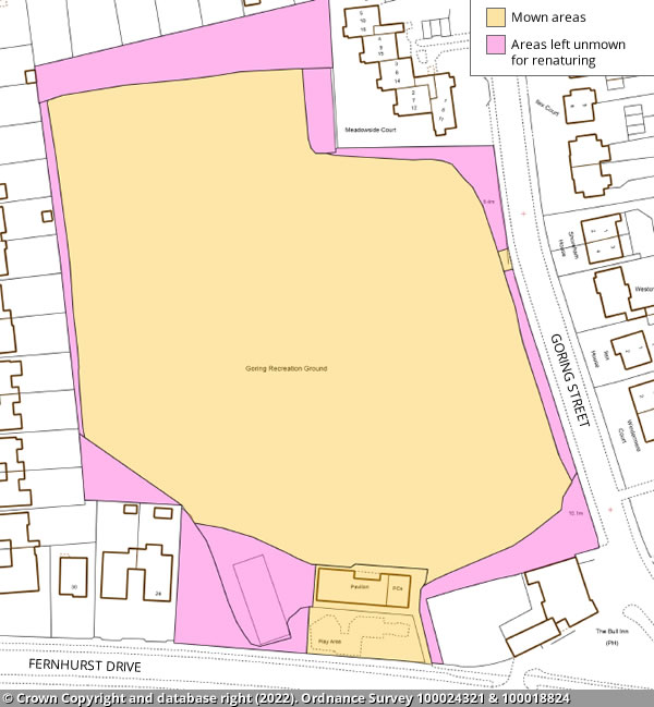
Goring Recreation Ground
The main area of the park will be mown.
There will be unmown areas to allow renaturing:
- around the park's perimeter edges
- under trees
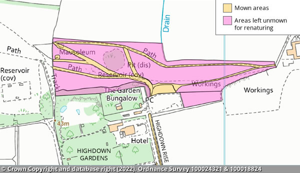
Highdown Hill
The majority will be unmown to allow for renaturing, with the picnic area and footpaths being mown.
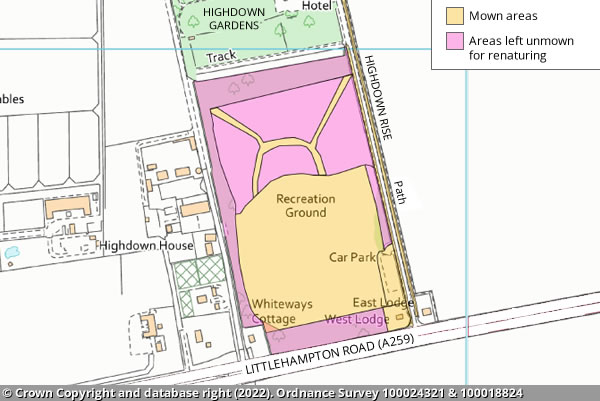
Highdown Recreation Ground
The south area of the field where the football pitches are will be mown as well as footpaths to the top of the site.
The northern third will be unmown to allow for renaturing the perimeter edges, excluding the car park will also be unmown.
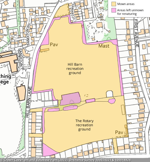
Hill Barn and The Rotary recreation grounds
The main area of the park will be mown.
There will be unmown areas to allow renaturing:
- around the park's perimeter edges
- under trees
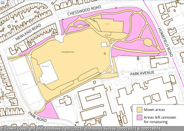
Homefield Park
The main field will be mown as well as the playground and surroundings of the paths.
Areas that will be left unmown to allow for renaturing include the east end of the park where there is significant tree coverage, the triangle opposite The Haven community gardens and the strip of land that runs north of the path from Park Road to Chesswood Road.
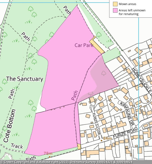
Honeysuckle
The majority of this site will be unmown to allow for renaturing.
The car park will be mown and the entrance at Furze Road.
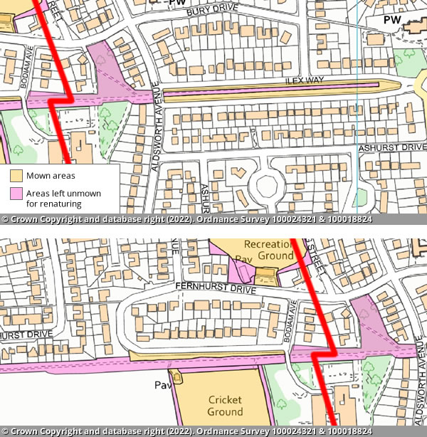
Ilex Way
The majority of Ilex Way will be left unmown to allow for renaturing.
There will be a strip either side of the road way that is mown.
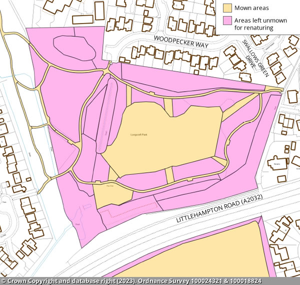
Longcroft Park
The central field, playground and paths will be mown.
The rest of the park will be unmown to allow for renaturing.
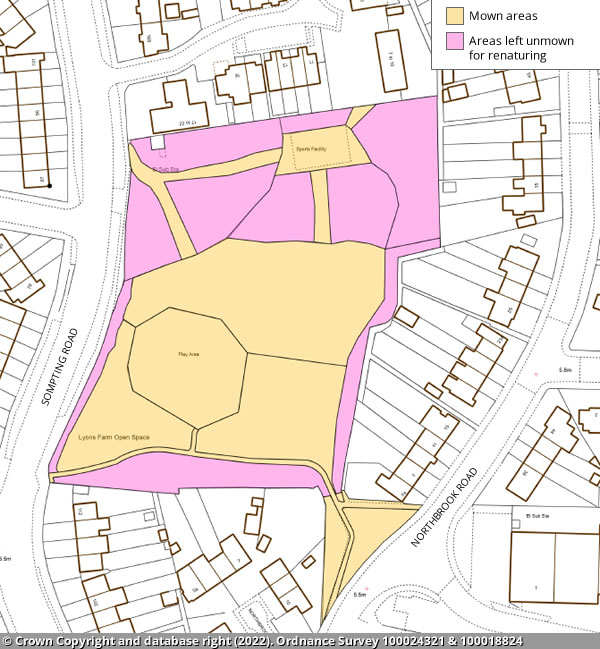
Lyons Farm open space
The main area of the park will be mown.
There will be unknown areas to allow renaturing these will be around the park's perimeter edges and the area to the north of the site where there is tree coverage with a path being mown in to allow for ease of access to the gate and to the basketball pitch.
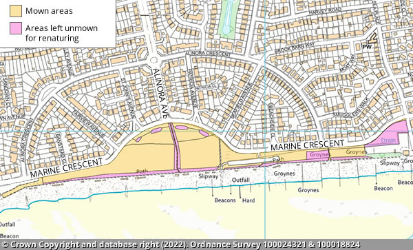
Marine Crescent
The main area of the park will be mown.
The bank along the southern side will be left for renaturing along with two patches: one opposite Alinora Crescent at the eastern end, and another behind the yacht club.
Marine Gardens
The main area of the park will be mown.
There will be unmown areas to allow renaturing:
- the area to the east of the café building
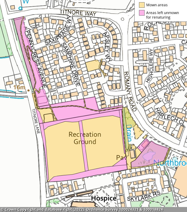
Northbrook Recreation Ground
and Pennycress Avenue
Northbrook Recreation Ground
- The football pitches, the playground and the car park area will be mown.
- Other areas such as along the perimeter edges in between the two pitches and around the pond will be left unmown for renaturing.
Pennycress Avenue
- The majority of this site will be unmown for renaturing with the footpaths mown.
Palatine Park
The main area of the park will be mown.
There will be unmown areas to allow renaturing around the park's perimeter edges, other than the car park area.
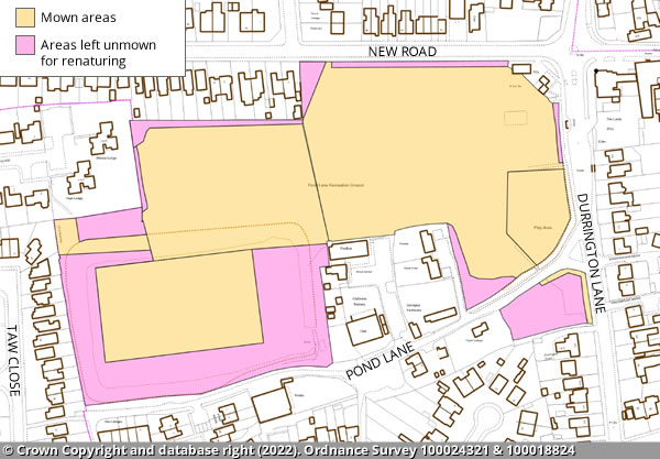
Pond Lane
The main area of the park will be mown.
There will be unmown areas to allow renaturing:
- a wide section of the perimeter in the bowl area and around the park's perimeter edges
- the area on the junction of Pond Lane and Durrington Lane will be left apart from the path edges
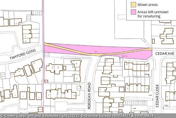
Roedean Road open space
The majority of this site will be left unmown for renaturing with a footpath mown through from east to west.
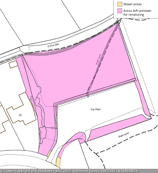
Storrington Rise car park
The initial entrance will be mown, the rest will be left unmown to allow for renaturing.
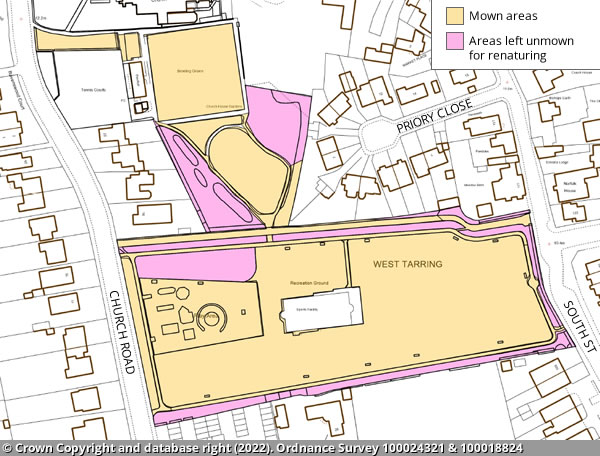
Tarring Park and Church House Grounds
The main area of the park will be mown.
There will be unmown areas to allow renaturing:
- around the park's perimeter edges
- under trees
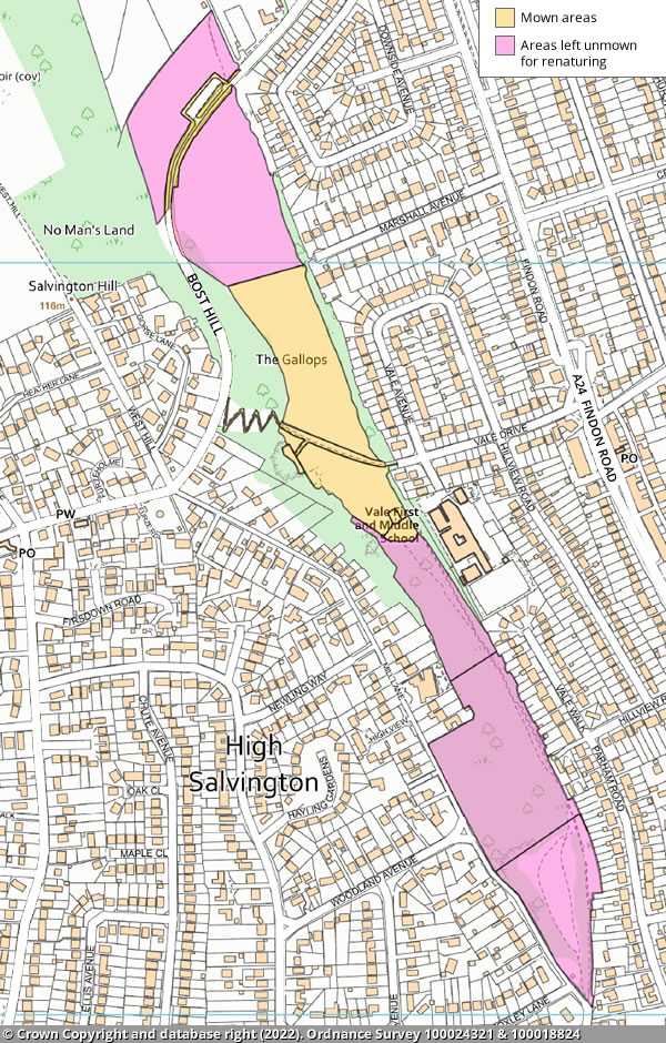
The Gallops
The majority of this site will be unmown to allow for renaturing, except for the field area to the south of the zigzag path to the wood line.
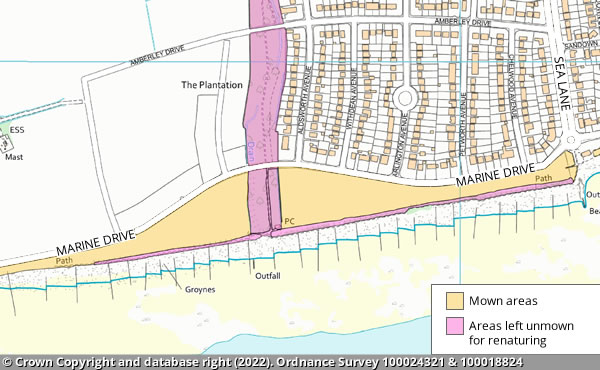
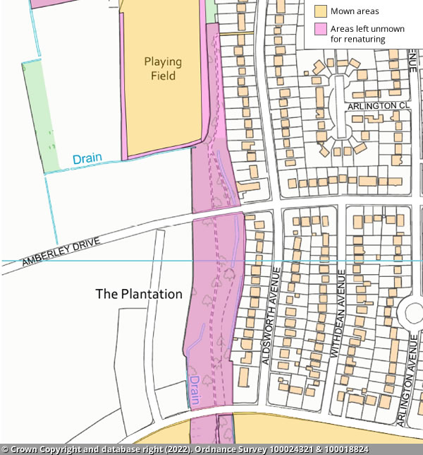
The Plantation
This site will be left unmown for renaturing, other than the footpath entrance to the north which will be mown.
Victoria Park
The main area of the park will be mown.
There will be unmown areas to allow renaturing:
- under trees
- the section of field to the south of the playground
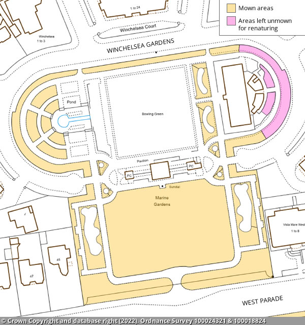
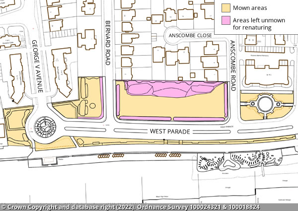
West Parade
The main area of the park will be mown.
There will be unmown areas to allow renaturing:
- along the park's perimeter edges
- the area to the back of the greenspace between Bernard Road and Anscombe Road
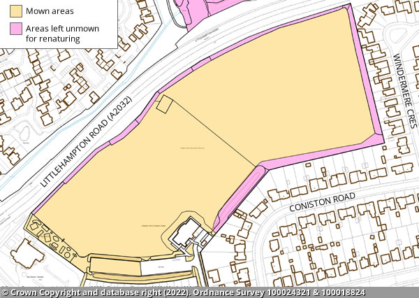
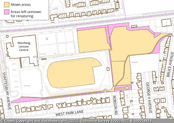
West Park
The main area of the park will be mown.
There will be unmown areas to allow renaturing:
- under trees
- the triangular section between the entrance at Bruce Avenue and the allotments

Need assistance with this service?
Get in touch:
Parks & Foreshore:
Problem with this page?
Page last updated: 13 October 2023