

Preparatory work on Shoreham flood defences begins
Released: Friday, 21 August 2026
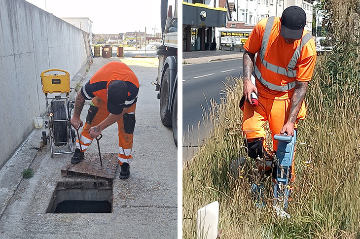
As part of the preparatory work ahead of the construction of the new flood defences to protect Shoreham from the River Adur, we've had contractors examining the drains running under and along the site.
It would be fair to say that a lot of silt had built up over time in the drains, so the team has been power-blasting it out of the pipes to clear them.
A steel-piled concrete, brick and flint wall up to 2.2 metres in height will be built next to the A259 Brighton Road along the Sussex Yacht Club boundary to protect dozens of nearby homes and businesses.
The project involves the Environment Agency, West Sussex County Council and Sussex Yacht Club and will also see a pathway running alongside the northern side of the flood wall between Mariner Point and the Shoreham footbridge.
Scans have also been made of the ground where the wall and pathway will stand, to identify any underground challenges that will need to be dealt with, such as phone or electricity cables, gas pipes and water connections.
The rising sea level means Shoreham is under increasing risk of further flood damage during severe weather so it's vital that this wall is built to protect the homes and businesses in the low-lying section of the town.
To learn more about the project see:
Photos: contractors inspecting the silt build-up in drains, and scanning the ground where the Shoreham flood defences will go
(PR26-073)
Page last updated: 09 October 2026